1 Preliminary Maps and Research
In this chapter, we will introduce our research, possibly including a summary of our first brainstorming, and, more importantly, present the first descriptive maps and explain how they give us clues on how to approach the analytical core of this spatial analysis project
1.1 Historical background
Dresden originated as a small settlement on the left bank of the Elbe and remained modest until the 16th century, when it became the capital of the Protestant Electorate of Saxony after the Schmalkaldic War. Under Elector Moritz, the city expanded rapidly with major architectural and urban developments. In the 18th century, it became a key cultural and political center as the royal residence of the Polish kings, marked by the construction of prominent monuments like the Zwinger and the Frauenkirche. Throughout the 19th century, Dresden continued to grow, becoming the capital of the Kingdom of Saxony and undergoing a major population boom.
The 20th century brought devastation with the Allied bombing in 1945, which destroyed much of the city, including the Frauenkirche. Following reunification, major reconstruction efforts began in the 2000s, including the faithful rebuilding of Neumarkt square and other historical landmarks, with a mix of traditional and modern residential architecture.
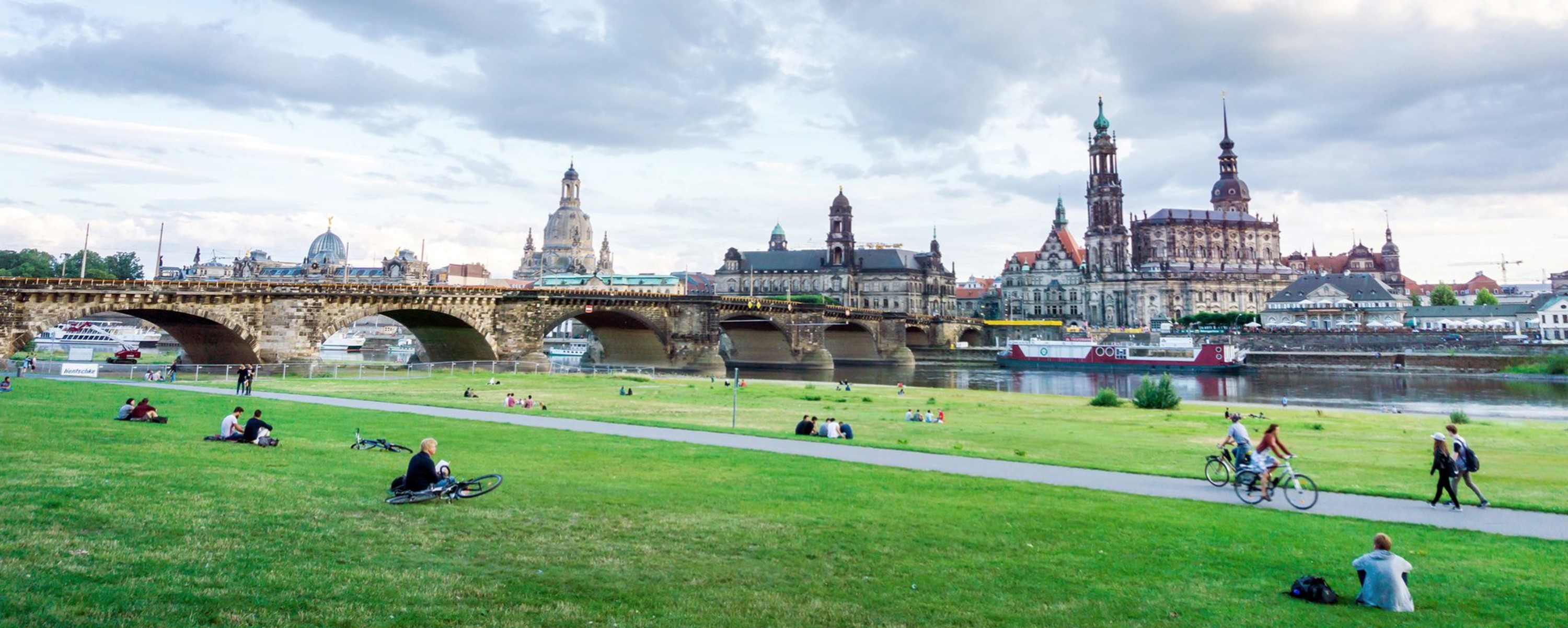
A key feature that emerged from historical photographs is the extensive use of the riverfront—large green meadows cutting through the urban fabric, which were historically used for social, economic, and cultural activities. These strips of grass, still visible today, offer clues to a spatial element that defines Dresden’s atmosphere: a city shaped not only by its architecture and history but also by its open, green relationship with the Elbe River.
Dresden has also faced major ecological challenges, notably the catastrophic Elbe floods of 1845 and 2002—the latter setting a new record and causing severe damage, much of which has since been repaired. These flood events highlight the importance of integrating ecosystem restoration and climate resilience into the city’s spatial planning.
1.2 Natural elements
Dresden is considered one of the greenest cities in Europe, with approximately 62% of its total area covered by forests, parks, and green spaces. This extensive green infrastructure includes the large woodland of the Dresdner Heide in the north and the Großer Garten in the city center, contributing to both ecological richness and urban quality of life. The city’s location in the Elbe Valley, framed by vineyards and wooded hills, is defined by the Elbe River, which meanders through the urban fabric and is bordered by wide river meadows. These meadows, cutting across the city, have historically hosted a variety of uses and activities—visible in old photographs—and remain a defining feature of Dresden’s atmosphere and spatial identity.
The Environment Office, responsible for nature conservation, places great emphasis on the protection of biotopes within the city. These areas not only serve as essential refuges for rare and endangered species, such as the beaver and corn crake, but also function as peaceful recreational spaces for residents. The presence of such species within the urban core is seen as a significant achievement in local conservation efforts and a testament to the ecological quality of Dresden’s landscape.
To further support the integration of nature into the city, Dresden’s current landscape plan is guided by the concept “Dresden—the compact city in the ecological network” (“Dresden – die kompakte Stadt im ökologischen Netz”). This approach emphasizes the need to balance urban density with ecological connectivity. The plan divides the city into sub-areas and introduces an ecological network structured through both net elements (functional spaces, high-value areas, ecological corridors, and green axes) and cell elements (ranging from compact urban cells to flexible and rural ones). Rather than defining fixed protected zones, this framework serves as a planning tool that guides future land use and development while respecting the city’s natural systems and polycentric structure.
The plan proposes 27 specific measures to guide future urban and landscape planning, aiming to protect, enhance, or restore ecological functions in different parts of the city. These measures provide orientation for decision-making across various departments and help ensure that Dresden continues to evolve as a resilient, biodiverse, and livable green city.
1.3 Built Environment
Dresden’s built environment reflects a complex layering of historical reconstruction, post-war development, and more recent car-centric urban expansion. The city is most recognizably shaped by its flood control strategies, which have left a prominent mark in the form of the wide, grassy Elbe meadows that traverse the urban core. While these meadows serve as a natural buffer for high waters, they remain largely undeveloped green corridors with limited ecological or recreational diversity. Beyond these, Dresden’s green spaces are relatively limited, with only a few notable urban parks and one major urban forest. Much of the city’s later development—particularly in the post-war and post-reunification periods—has prioritized road infrastructure and low-density layouts, contributing to a fragmented urban fabric that often lacks pedestrian accessibility and integrated ecological planning. This context underscores the need for rethinking the relationship between the built environment and the landscape to better support both human and non-human life.